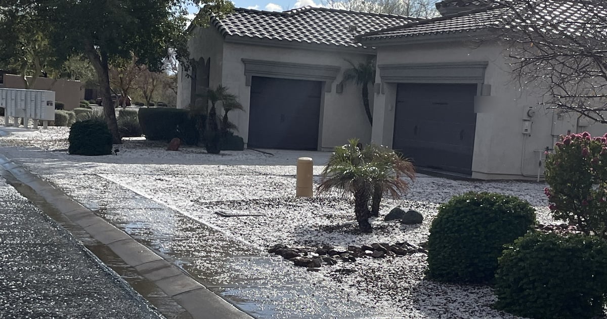
Every August it happens somewhere in the West Valley: a dip in the road that was bone dry at noon has two feet of brown water running through it by four o'clock. The people who have lived here a while turn around. The people who just moved from somewhere with rivers you can see year-round look at the blue sky and wonder what the fuss is about. That gap — between what the desert looks like and what it does when the monsoon opens up — is why a home in Peoria, AZ, Surprise, or Goodyear can sit in a mapped flood zone without a drop of water in sight on the day you tour it. The good news is that a property's relationship with water is written down: on a FEMA map, in the seller's disclosure, and in your lender's file. You can read all three before you write the offer. Here is where to look, what the letters mean, when flood insurance stops being optional, and what to do when the map says one thing and the lot says another.
Why a desert has flood zones
The West Valley is crossed by washes that are dry for most of the year and become real rivers for a few hours at a time. The Agua Fria River runs south from Lake Pleasant along the west side of Peoria, AZ toward Avondale. New River comes out of the north and cuts through Peoria and Glendale, and Skunk Creek joins it south of Bell Road. The Flood Control District of Maricopa County has named the New River crossings, Skunk Creek, and the Agua Fria corridor among the areas of the Valley most prone to flooding during heavy monsoon storms, alongside Cave Creek Wash and Indian Bend Wash on the other side of town. Smaller unnamed washes feed all of them, and many newer subdivisions in North Peoria, Surprise, and Buckeye were built across ground that used to carry that water.
There is a second kind of desert flooding that surprises people even more: sheet flow. On flat ground with no defined channel, a hard storm can push a broad, shallow sheet of water — one to three feet deep — across a whole neighborhood. FEMA maps that as its own zone, and Peoria's floodplain ordinance defines it as an area where "the path of flooding is unpredictable." Monsoon season runs June 15 through September 30, and the storms behind both kinds of flooding are the same afternoon thunderstorms that make the creosote smell so good. One more thing the county says plainly: floodplains exist in areas that have not been studied yet. The map is the starting point, not the last word.
Reading the letters: what a FEMA flood zone actually means
FEMA publishes a Flood Insurance Rate Map, or FIRM, for every community that participates in the National Flood Insurance Program. Each parcel lands in a zone, and the zone is a letter code. For a West Valley buyer, these are the ones that matter:
- Zone A / AE. The Special Flood Hazard Area, also called the 100-year floodplain. A one percent chance of flooding in any given year. AE means FEMA did a detailed study and published a Base Flood Elevation (BFE), the height floodwater is expected to reach. Plain A means no BFE has been set. This is the zone where a federally backed mortgage will require flood insurance.
- Zone AO / AH. Also part of the Special Flood Hazard Area, but for shallow flooding — sheet flow (AO) or ponding (AH) averaging one to three feet. These are common on the flat ground of the West Valley and carry the same insurance requirement as AE.
- Shaded Zone X. Moderate risk. Between the one percent floodplain and the 0.2 percent (500-year) floodplain. No mandatory insurance, but FEMA still recommends it.
- Unshaded Zone X. Minimal mapped risk. Most West Valley subdivisions sit here. It does not mean the lot cannot flood; it means FEMA has not mapped a one-in-500 flood reaching it.
- Floodway. The channel itself plus the land needed to carry the base flood. Building here is tightly restricted, and a lot that backs to a wash can have a floodway along its rear line while the house pad sits in Zone X.
Two FEMA facts put those letters in perspective. Over a 30-year mortgage, a home in a high-risk zone has a one-in-four chance of flooding at least once. And from 2014 to 2024, nearly one-third of NFIP claims came from outside high-risk areas. Zone X is lower risk, not no risk.
The ten-minute lookup for any West Valley address
You do not need to wait for the lender or the title company. Do this the same night you decide you like the house:
- Search the address at FEMA's Flood Map Service Center. The address search shows the zone on screen and lets you print a FIRMette, a one-page cutout of the official map with the property on it. Save the PDF to your transaction folder.
- Cross-check on the county's Floodplain Viewer. The Flood Control District of Maricopa County publishes an online map with both the current FEMA floodplains and the pending ones that have been studied but not yet adopted. That "pending" layer is the one that can change your insurance picture after closing, and FEMA's site does not show it.
- Ask the county for a written determination. The District's Flood Hazard Information Request form returns an official Flood Insurance Rate Map information sheet for the parcel, and there is no fee. It is a cleaner document to hand a lender or an insurance agent than a screenshot.
- Know who regulates the floodplain where you are buying. The county's Flood Control District handles floodplain management for unincorporated Maricopa County and for Surprise, Buckeye, Litchfield Park, El Mirage, and Youngtown. Peoria, Glendale, Goodyear, and Avondale each run their own program. That administrator is who you call about a permit, a variance, or whether the casita or pool can go where you want it.
- Read the plat and the title commitment for drainage easements. A drainage easement across the rear of a lot is a recorded promise that water gets to move through there. You cannot wall it, build over it, or fill it.
Because floodplain maps, zone boundaries, HOA rules, taxes, and insurance requirements can change, verify the details for the specific property you are considering.
What the seller has to tell you
Arizona sellers disclose what they know, and the standard forms ask about water directly. The Arizona REALTORS® Seller's Property Disclosure Statement asks whether the seller is aware that any part of the property is in a FEMA Special Flood Hazard Area, whether the seller carries flood insurance, and about past flooding, ponding, sheet flow, wash flow, drainage, and erosion — whether or not it caused damage or was fixed. Read that section slowly. A "yes" on drainage with a note that says "regraded the side yard in 2022" is useful information, not a deal-killer, and it tells you exactly where to send the inspector.
If you are buying acreage or a lot in unincorporated Maricopa County — a county island, or land north of the city limits toward Lake Pleasant — Arizona adds a second document. Under A.R.S. 33-422, a seller of five or fewer parcels that are not part of a recorded subdivision must give you a sworn Affidavit of Disclosure at least seven days before closing. Item six states whether any portion of the property is in a FEMA-designated regulatory floodplain. The affidavit is recorded with the deed, and receiving it opens a five-day window in which you can rescind. A subdivision lot inside Peoria or Surprise city limits comes with the SPDS instead.
When flood insurance stops being optional
Here is the part that changes your monthly payment. If the home sits in a Special Flood Hazard Area (any A zone, including AO and AH) and you are using a federally backed mortgage — which covers conventional loans sold to Fannie Mae or Freddie Mac as well as FHA and VA — federal law requires flood insurance as a condition of the loan. The lender makes that call from the FIRM, and it is a yes-or-no determination: in the zone or not, with no look at how high the house sits above the flood level.
- Your homeowners policy does not cover flood. Standard homeowners insurance excludes rising water. Flood coverage is a separate policy, either through the NFIP or a private flood insurer.
- The 30-day wait does not apply at closing. NFIP policies normally take effect 30 days after purchase, but when the policy is bought in connection with a loan closing, the waiting period is waived and coverage starts at funding, as long as the application and premium are in before closing. Do not let anyone tell you the escrow has to be extended a month for flood insurance.
- Zone X coverage is worth a quote. If the address is in shaded or unshaded X, nobody will require a policy. Given that nearly a third of claims come from outside high-risk areas, get a quote anyway, especially on a lot that backs to a wash or sits at the low end of a street.
- The program itself has a calendar. Congress authorizes the NFIP in stretches. As of this writing, its authority to write new policies is set to expire on December 11, 2026 unless Congress extends it again. During a lapse, the NFIP cannot issue new or renewal policies, existing policies stay in force, a seller's NFIP policy can often be assigned to the buyer, and private flood insurance is unaffected. If your closing lands near an expiration date and the home is in an A zone, ask your lender early which path they will accept.
When the map says yes and the lot says no
Maps are drawn at the scale of a neighborhood, not a house pad. A West Valley lot can sit inside a mapped floodplain while the finished floor of the house sits well above the Base Flood Elevation, because the builder graded the pad to make that true. Three tools exist for that situation:
- The elevation certificate. A surveyor's document that records the elevation of the lowest floor and the adjacent grade against the BFE. Ask the seller whether one exists; if the home was built in a floodplain after the community joined the NFIP, one was probably required at construction. The county says a new one from a surveyor typically runs about $400 to $1,000 depending on the job.
- The Letter of Map Amendment (LOMA). If the elevation certificate shows the structure sits on natural ground above the BFE, you can apply to FEMA to have the building removed from the mapped floodplain. If approved, the lender may then choose not to require flood insurance. The county's Flood Control District will walk homeowners through the application.
- The Flood Hazard Determination Review. If you believe the lender simply put the house in the wrong zone, you can ask FEMA to review the determination. The request must be postmarked within 45 days of the lender's notice.
A local detail that tells you how seriously the cities take this: Peoria's floodplain ordinance sets its own Regulatory Flood Elevation one full foot above FEMA's Base Flood Elevation for new habitable construction in the floodplain. That extra foot is why an elevation certificate on a newer Peoria home in a mapped zone often comes back with room to spare.
Beyond the map: what to check on the lot itself
The zone letter tells you about the floodplain. It does not tell you whether the side yard drains toward the foundation or whether the culvert under the driveway has been full of sediment since the last storm. During the inspection period, walk the lot with water in mind:
- Does the grade fall away from the house on all four sides, or does one side yard pond?
- Where does the roof drain, and where does that water go once it hits the ground?
- If the lot backs to open desert or a wash, is there a visible high-water line, debris caught in the fence, or scouring at the base of the wall?
- Are there culverts, rip-rap, or a concrete-lined channel along the street, and are they clear?
- Is any part of the lot inside a drainage easement, a floodway, or a retention basin tract?
A retention basin in the common area is not a warning sign; West Valley subdivisions are engineered to hold their own storm water on site, and those grassy bowls fill on purpose. And do not forget the drive home. Arizona's "Stupid Motorist Law" (A.R.S. 28-910) lets public agencies bill a driver for the cost of a rescue after going around a flood barricade, and about two feet of moving water is enough to carry away an SUV. If a property's only route in crosses a wash at grade — common on county-island roads north of Peoria, AZ and around Waddell — ask the seller how often that crossing closes, and drive it once after a storm before you close.
One West Valley example
Picture a couple moving up from a subdivision lot in Glendale to a one-acre property on the north edge of Peoria, AZ, where the ground still drains the way the desert built it. The listing says nothing about flooding. They run the address at FEMA's map center the night of the second showing and find the house pad in unshaded Zone X, but the rear third of the lot in Zone AO with a drainage easement recorded along the back property line. The seller's disclosure says no flooding, no insurance. Their lender, reading the same map, flags the parcel for a determination. Because the structure sits outside the AO area and the seller has the builder's elevation certificate in a drawer, the determination comes back with no mandatory insurance requirement. The couple buys a Zone X policy anyway, keeps the easement clear when they plan the shop building, and adds a swale where the inspector noticed the side yard ponding. None of that was visible from the curb, and all of it took about two evenings to sort out.
Before you write the offer: the flood checklist
- FEMA FIRMette printed and saved for the address.
- County Floodplain Viewer checked for current and pending floodplains.
- Written Flood Hazard Information sheet requested from the Flood Control District (free).
- Correct floodplain administrator identified (county district, or the city for Peoria, Glendale, Goodyear, and Avondale).
- SPDS flood and drainage answers read and questions sent to the seller.
- For unincorporated land: A.R.S. 33-422 Affidavit of Disclosure received and item six checked.
- Elevation certificate requested from the seller if any part of the lot is in an A zone.
- Flood insurance quote in hand (NFIP or private) before the inspection period ends, whether or not the lender requires it.
- Lender's flood determination reviewed (45-day review window if you disagree).
- Drainage easements and floodway lines located on the survey; lot walked for grade, culverts, and high-water evidence.
Ready to compare your options? Schedule a friendly consultation with Stephanie White so you can build a simple, step-by-step plan for your next move.
Frequently asked questions
How do I find out if a house in Peoria, AZ is in a flood zone?
Search the address at FEMA's Flood Map Service Center for the official zone, then check the Flood Control District of Maricopa County's Floodplain Viewer for pending map changes. For a written determination, submit the District's Flood Hazard Information Request form; there is no fee. For questions about permits or building in the floodplain inside city limits, the City of Peoria runs its own floodplain program.
Do I have to buy flood insurance in Arizona?
Only if the home is in a FEMA Special Flood Hazard Area (an A, AE, AO, or AH zone) and you are using a federally backed mortgage. The lender determines that from the FIRM. Outside those zones, flood insurance is optional, but homeowners insurance does not cover flood, and FEMA reports that nearly a third of claims from 2014 to 2024 came from outside high-risk areas.
What does Zone AO mean on a West Valley flood map?
Zone AO is a shallow-flooding zone for sheet flow, where water is expected to spread across the ground one to three feet deep without a defined channel. It is part of the Special Flood Hazard Area, so it carries the same mandatory-insurance rule as Zone AE for federally backed loans. It is common on the flat ground of Surprise, North Peoria, and Buckeye.
Can I get a house removed from a flood zone?
Sometimes. If an elevation certificate shows the structure sits on natural ground above the Base Flood Elevation, you can apply to FEMA for a Letter of Map Amendment. If approved, the building is considered outside the mapped floodplain and the lender may drop the insurance requirement. The county's Flood Control District can help with the application.
Is there a waiting period for flood insurance when I buy a home?
NFIP policies normally have a 30-day waiting period, but it is waived when the policy is purchased in connection with a loan closing. Coverage takes effect at funding as long as the application and premium are submitted on or before closing. Confirm the timing with your lender and agent, and note that the NFIP's own authorization has an expiration date Congress must keep extending.
Does the seller have to disclose flooding in Arizona?
Sellers disclose known material facts, and the Arizona REALTORS® Seller's Property Disclosure Statement asks specifically about Special Flood Hazard Area status, flood insurance, and past flooding, ponding, sheet flow, wash flow, drainage, and erosion. For five or fewer unsubdivided parcels in unincorporated county land, A.R.S. 33-422 also requires a sworn Affidavit of Disclosure that states whether the property is in a FEMA-designated regulatory floodplain.
What is the difference between a floodplain and a floodway?
The floodplain is all the land expected to be under water in the one-percent (100-year) flood. The floodway is the channel plus the strip of land beside it that has to stay open to carry that flood without pushing the water higher. Building in a floodway is heavily restricted. A lot backing to New River or the Agua Fria in Peoria, AZ can have a floodway along its rear line while the house sits in a lower-risk zone.